
Hiking in the Bavarian Forest
Tangible mountain energy

Strength comes from the inside – a desire for exercise, vitality and inner balance can be achieved effortlessly in the inspiring nature of the Bavarian Forest.
Lush green meadows on gentle hills, interspersed with the fresh colors of meadow flowers. Deep green forests rise up against a blue sky.
Wonderful hiking routes and well-signposted paths in and around Kollnburg in the Bavarian Forest are ideal for families and hikers of all ages.
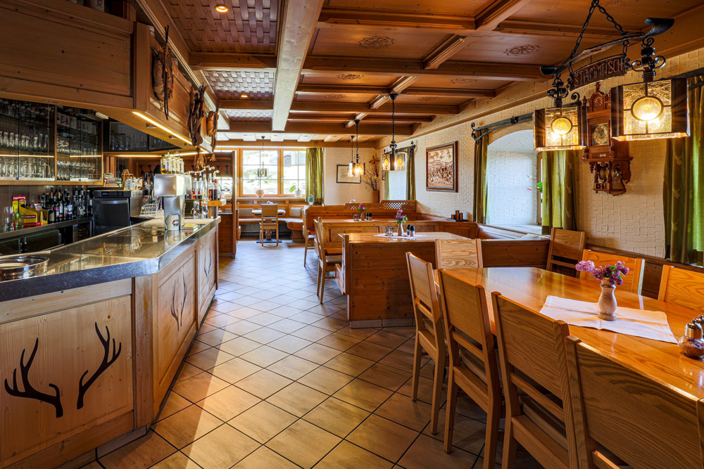
3-star Burggasthof - the ideal starting point for your hiking vacation!
Main hiking trails
Hiking route 1:
Burggasthof Hauptmann Kollnburg Kirchplatz – Windsprach – Hochstraß – Pröllersäge – Markbuchen (Total: 7 km)
Hiking route 2:
Burggasthof Hauptmann Kollnburg Kirchplatz – Windsprach – Wieshof – Kagermühle – Unterriedl – Hinterviechtach (Total: 6 km)
Circular hiking trails
Hiking route 1: Burggasthof Hauptmann Kollnburg Kirchplatz – Sedlhof – Münchshöfen – Stein – Ramersdorf – Schwaben – Distelberg – Oberhofen – Kollnburg Kirchplatz (Total: 14 km)
Hiking route 2: Burggasthof Hauptmann Kollnburg Kirchplatz – Schloßberg – Reichsdorf – St. Anton/Viechtach – Hammer – Gsteinach – Oberhofen – Rechertsried – Kollnburg Kirchplatz (Total: 10 km)
Hiking route 3: Burggasthof Hauptmann Kollnburg Kirchplatz – Dornach – Baierweg – Wies – Schmidaitnach – Aumühle – Vorderau – Karglhof –
Kollnburg Kirchplatz (Total: 8 km)
Hiking route 4: Burggasthof Hauptmann Kollnburg Kirchplatz – Schulstraße – Windsprach – Bach – Kagermühle – Pröller – Hinterwies – Münchshöfen – Sedlhof – Kollnburg Kirchplatz (Total: 12 km)
Events in Kollnburg
Guided hikes, romantic moonlight walks, evening strolls in the castle and many other events can be found in the Kollnburg community events calendar.
Tour search Viechtacher Land
Hiking trails, circular hiking trails, winter hiking trails and destination hiking trails in Kollnburg and the surrounding area, as well as cycle tour suggestions can be found under the tour search Viechtacher Land.
Hiking tours around Kollnburg
From the gently rolling foothills of the Bavarian mountains to wild and romantic nature trails on the banks of the Riedbach stream, there are a variety of tours to choose from near the Burggasthof Hauptmann in Bavaria. In total, the hiking trail network around Kollnburg comprises around 100 km of marked hiking trails.
Panoramic circular trail Pröller
Panoramic circular trail Pröller
Mountain hike from the resort of Kollnburg to the Pröller (1,048 m) in the Bavarian Forest. At 1,048 m, the Pröller is the highest mountain in Kollnburg. Although the summit of the Pröller already belongs to the neighboring municipality, more than 2/3 of the northern side of the Pröller lies within the municipality of Kollnburg.
Pröllersteig nature trail
Pröllersteig nature trail
The “Holzwurm” logo leads you along the approx. 3.5 km long circular trail to various stations that provide information about the history and changes to nature and the environment in the Bavarian Forest over the last few centuries. Many rare plant species and structures of old cultural landscapes can still be found in the “Pröllersteig” hiking area in particular.
Hike to the Teufelsstein
Hike to the Teufelsstein
If you would like to hike the Teufelsstein, it is best to start at the town hall in Kollnburg and follow the “Rundwanderweg 12” trail via Sedlhof in the direction of Münchshöfen. After about an hour’s walk, during which you can enjoy wonderful panoramic views of the village of Kollnburg and the highest peaks in the Bavarian Forest, you will come across the legendary “Devil’s Stone” in the forest.
Hike to the Kesselstein on the Distelberg
Hike to the Kesselstein on the Distelberg
Exactly on the border between the three municipalities of Kollnburg, Prackenbach and Viechtach, you will find a 3000-year-old cup stone. Discovered by chance, the stone has three man-made round indentations which indicate that it was originally used as a place of worship.
Burgstallweg with Liebesfelsen and Pfarrgarten
Burgstallweg with Liebesfelsen and Pfarrgarten
The Burgstallweg in Kollnburg is part of the “Baierweg”, one of the oldest mule tracks in the Bavarian Forest. The old path through the site of the prehistoric castle stables with its charming rock formations connects the upper and lower village.
Panoramic view Aitnachtal
Panoramic view Aitnachtal
The best way to reach this charming vantage point with views of the Aitnachtal valley and far into the mountain ranges around Hohen Bogen, Kaitersberg and Arber is from the idyllic Pfeiffenbrunn Kneipp spa in Winklern. Follow the signs up towards Ödwies (blue 3).
GOLDSTEIG-Zubringer - Kollnburg-Pröller
GOLDSTEIG-Zubringer - Kollnburg-Pröller
The Goldsteig feeder trail offers a challenging tour from the Antoni-Pfahl in Viechtach via Kollnburg, the water wheel on the Riedbach and the steep slope of the Pröller north slope to the 1,048 m high Pröller summit. Once there, hikers are captivated by the magnificent view and the breathtaking beauty of nature.
Beautiful views
Our "3 thousands"
- Hirschenstein (1095m) with observation tower
- Pröller with summit cross (1048 m)
- Predigtstuhl with summit cross Gipfelkreuz (1024 m)
A magnificent view awaits you on these peaks!
Other worthwhile destinations around Kollnburg
- Käsplatte – a sea of stone
- Kasten 822 m - the highest mountain in Kollnburg
For summiteers
Lusen (1373m)
Located in the middle of the Bavarian Forest National Park, the summit area, which is completely covered in granite boulders and which, according to legend, was piled up by the devil over a treasure of gold, is a very striking mountain. Once at the top, the treeless summit area rewards you with a fabulous view over the Bavarian and Bohemian Forest. In fact, the rocky peak is a geological sight that makes the Lusen unmistakable.
Großer Arber (1456m)
The highest mountain in the Bavarian Forest. It is therefore also known as the “King of the Bavarian Forest”. The shortest ascent is from the Arber valley station, the longest from Bodenmais, past the Rießloch waterfalls, via the Chamer Hütte to the Kleiner Arber and then to the Großer Arber. You can also reach this mountain comfortably by cable car, and once at the top there are beautiful summit hiking trails.
Rachel (1453m)
Also located in the Bavarian Forest National Park and the 2nd highest mountain in the Bavarian Forest. There are many starting points to hike this mountain. The path past the Rachelsee lake and the Rachelkapelle chapel is particularly beautiful. The summit cross offers a view of the Frauenau drinking water reservoir.
This is just a small selection of the hiking experiences in the Bavarian Forest!
We at Gasthof Hauptmann will be happy to advise you during your hiking vacation in Kollnburg in the Bavarian Forest. Send us a no-obligation inquiry today and find out more about the hiking opportunities around Gasthof Hauptmann.